INTERESTING USA MAPS
Pictures provided by Linda REINING ('64)
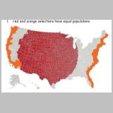
USA-01-Populations
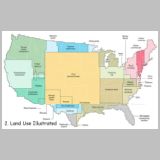
USA-02-Land-Use
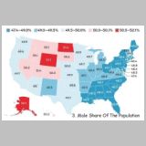
USA-03-Males
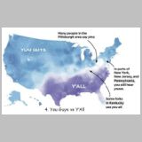
USA-04-YouGuys-YAll
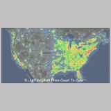
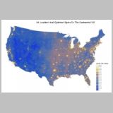
USA-05-Light
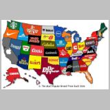
USA-06-Brands
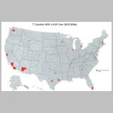
USA-07-GOP
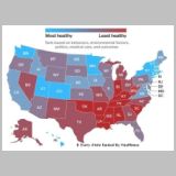
USA-08-Healthiness
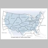
USA-09-Air-Traffic
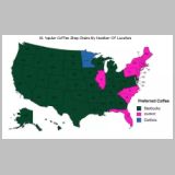
USA-10-Coffee-Shops
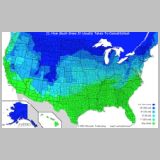
USA-11-Snow-Close-School
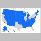
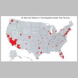
USA-12-Pop-Less_than_L.A
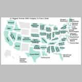
USA-13-Fortune1000
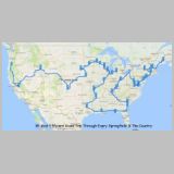
USA-14-Loudest
USA-15-Springfields
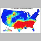
USA-16-Dang
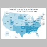
USA-17-Religious
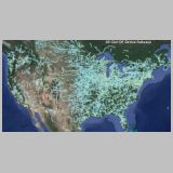
USA-18-Railways
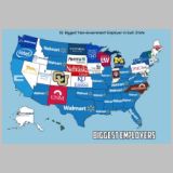
USA-19-Employers
USA-20-Population
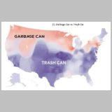
USA-21-Garbage-Trash
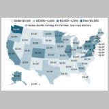
USA-22-Income
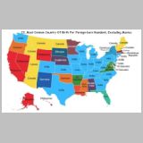
USA-23-Birth_Country
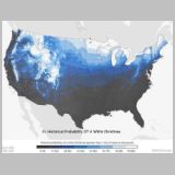
USA-24-White-Xmas
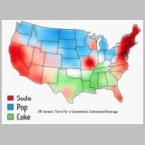
USA-25-Soda-Pop
Created by FREE IrfanView software